The key to a faster city commute isn’t just a better navigation app; it’s learning to synchronize your driving with the city’s underlying digital rhythm.
- Smart infrastructure like “green waves” creates predictable traffic patterns that you can learn to follow.
- Choosing the right tool (Waze vs. Google Maps) depends on a conscious trade-off between real-time data and personal privacy.
Recommendation: Instead of passively following directions, start actively reading the infrastructure’s signals to anticipate traffic flow and make smarter, faster decisions.
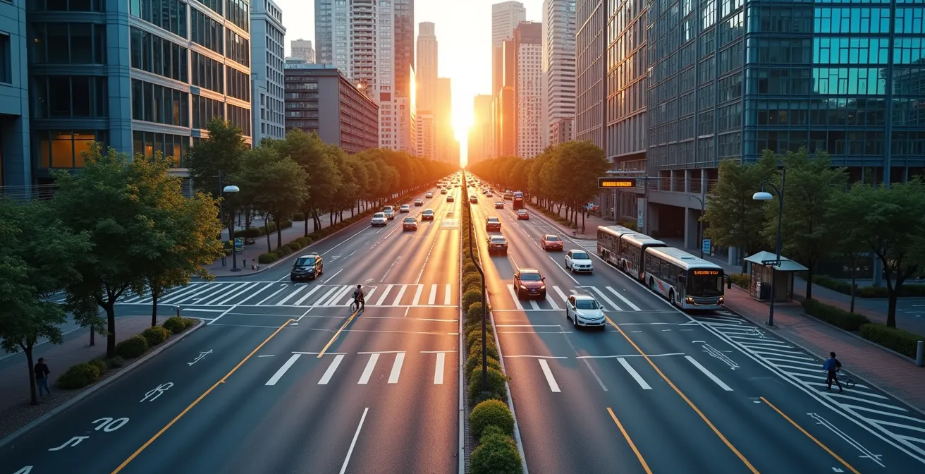
That familiar frustration of a city commute: you escape one red light only to be caught by the next, and the one after that. It feels like the city itself is working against you, turning a simple drive into a maddening game of stop-and-go. Most advice revolves around using the latest navigation app or planning your trip, but these are reactive measures. They treat the symptoms of urban congestion, not the cause. You’re still just a pin on a map, being told where to go next.
But what if the problem isn’t the traffic, but our approach to it? We see a chaotic mess of individual cars, but smart city infrastructure sees a single, manageable system. The secret to reclaiming your time isn’t to fight against this system, but to understand its language and synchronize with its digital pulse. This requires a mental shift: from a passive navigator to an active participant in an ongoing dialogue with the road.
This guide moves beyond generic tips. We will deconstruct the core systems that govern urban traffic flow. You will learn how to read and interpret the patterns of synchronized traffic signals, make conscious decisions about your data privacy, optimize the time-consuming hunt for parking, and even anticipate traffic changes by understanding how freight and real estate are reshaping your city. It’s time to stop fighting the red lights and start flowing with the green wave.
To help you master this new approach, this article breaks down the essential strategies for synchronizing your drive with the city’s intelligent infrastructure. Below is a summary of the key areas we will explore to transform your urban commute.
Summary: A Driver’s Guide to Smart City Synchronization
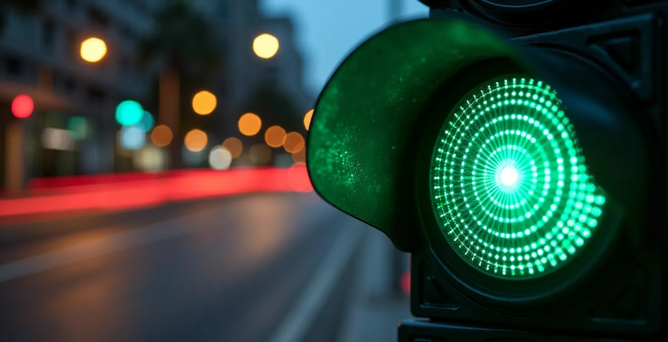
Understanding the green wave
The “green wave” is the most tangible expression of a city’s digital pulse. It’s a system where traffic signals along an arterial road are timed to allow a continuous flow of traffic over several intersections at a specified speed. For the driver who feels they hit every red light, understanding this system is the first step toward reclaiming control. It’s not magic; it’s a choreographed sequence. The goal is to join the “platoon” of vehicles moving at the system’s target speed, typically between 25-35 mph (40-56 km/h) in urban corridors.
To effectively ride this wave, you must shift from aggressive acceleration and braking to a smoother driving style. This involves the ‘Pulse and Glide’ technique: accelerating gently to the target speed, then easing off the throttle and coasting, making minor adjustments to maintain your position within the flow. Many smart corridors now feature LED guidance screens at their entrances, displaying the optimal speed you should maintain.
By synchronizing your speed, you are no longer fighting individual traffic lights but are instead collaborating with the entire corridor’s traffic management system. This not only reduces your travel time and frustration but also contributes to a more efficient urban environment. As a result of smoother traffic flow, studies show that green wave systems achieve up to a 10% reduction in CO2 emissions. It’s a clear instance where aligning with the system benefits both the individual driver and the city as a whole.
The data privacy fallacy
The real-time traffic data that powers green waves and rerouting suggestions isn’t created in a vacuum; it’s generated by us, the drivers. This creates a fundamental tension between efficiency and privacy. The common fallacy is to see this as a simple on/off switch, but the reality is a spectrum. The choice isn’t just *whether* to share data, but *what* data to share, *when*, and with *which* service. Understanding this “data trade-off calculus” is crucial for any smart city driver.
Different applications have fundamentally different models. Waze, for example, thrives on a constant stream of user-generated, real-time data. Your location, speed, and reports on hazards are the lifeblood of its famously accurate, instantaneous traffic updates. Google Maps, by contrast, often relies more heavily on aggregated, anonymized location patterns over time to predict traffic, supplemented with real-time probes. While both platforms anonymize data, Waze’s model requires more active and continuous participation from its users.
This table breaks down how different features collect and use your data, empowering you to make a more informed choice.
| App Feature | Data Collected | User Control Options |
|---|---|---|
| Real-time Traffic (Waze) | Continuous location, speed, route data | Can disable reporting, use ghost mode |
| Traffic Prediction (Google Maps) | Anonymized location patterns, search history | Location settings, incognito mode available |
| Community Reports | User-submitted incidents with location stamps | Optional participation, can browse without contributing |
Ultimately, there is no single “private” option. Using these services involves a transaction: you provide data (actively or passively) in exchange for convenience. The savvy driver understands this transaction and uses the privacy controls available—like Waze’s “ghost mode” or Google’s incognito mode—to manage their digital footprint strategically, rather than blindly accepting the defaults.
Optimizing urban parking
The hunt for parking can easily erase any time saved by brilliant navigation. In a smart city, optimizing parking is not a matter of luck but of strategy. It requires combining real-time data with a proactive plan that begins long before you reach your destination. Apps like Waze have started integrating this into their core service; for instance, when searching for destinations, Waze automatically suggests parking lots nearby, often complete with pricing information. This is the first layer of optimization: data-driven awareness.
However, the true optimization comes from moving beyond the most obvious, and often most expensive, options. The “Last-Mile” strategy is a powerful technique where you intentionally park in a guaranteed cheaper zone that is a five- or ten-minute walk from your final destination. This trades a short walk for significant cost savings and the elimination of search time. This approach works best when combined with an awareness of the urban rhythm, like knowing to avoid office building lots during business hours but leveraging them for 40-60% savings after 6 PM or on weekends.
Thinking like a logistician also means calculating your time’s value. If your time is worth more than $30 an hour, spending 15 minutes searching for a free spot has already cost you more than paying for a premium, guaranteed space. The following checklist provides a framework for turning the frustrating search for parking into a predictable, optimized process.
Your action plan: A framework for smart parking strategy
- Pre-trip identification: Use Waze’s parking suggestions feature to identify available spots with real-time pricing before arrival.
- Apply the ‘Last-Mile’ strategy: Intentionally park 5-10 minutes walking distance away in guaranteed cheaper zones.
- Demand forecasting: Check event calendars and peak hours to anticipate parking demand surges and avoid hotspots.
- Time-value calculation: If your hourly rate exceeds $30, recognize that premium parking saves money over a 15-minute search.
- Off-peak opportunities: Leverage office building lots after 6 PM and commuter lots on weekends for significant savings.
By adopting this strategic mindset, parking transforms from a source of stress into a solved equation in your urban travel plan.
Comparing navigation applications
The two giants of navigation, Waze and Google Maps, are often seen as interchangeable, but they are fundamentally different tools designed for different philosophies of driving. Choosing the right one is less about which is “better” and more about which aligns with your immediate goal. Waze is the ultimate tool for aggressive speed optimization. Its community-driven, real-time data allows for instant rerouting around accidents and jams, but this can lead to complex routes through side streets. As Tom’s Guide famously quipped, “Waze would tell you to drive through an active war zone to shave 5 seconds off your journey.”
Google Maps, on the other hand, offers a more balanced and comprehensive approach. It excels at planning complex trips with up to 10 stops, offers robust offline map capabilities, and seamlessly integrates public transportation options, making it superior for exploration and multimodal journeys. Its rerouting is slightly slower, often taking a minute or two to verify incidents before suggesting a new path, resulting in more stable and predictable routes.
This fundamental difference in approach is reflected across their feature sets. The following table highlights the key distinctions that should guide your choice of app for any given journey.
| Feature | Waze | Google Maps |
|---|---|---|
| Real-time rerouting | Instant (community-driven) | 1-2 minute verification delay |
| Multiple stops | 1 stop maximum | Up to 10 stops |
| Offline maps | Not available | Full offline download |
| Parking suggestions | Automatic with prices | Not available |
| Public transport | Not supported | Full integration with schedules |
| Speed optimization | Aggressive routing | Balanced approach |
The most effective strategy is often “app-stacking”: using Waze for your daily, traffic-heavy commute where every second counts, and switching to Google Maps for exploring a new city, planning a multi-stop errand run, or when your journey involves more than just driving. The choice becomes a conscious one based on the specific demands of the trip.
Planning multimodal journeys
The truly smart city driver knows that the fastest route isn’t always exclusively by car. Synchronizing with the city’s rhythm means recognizing when to leave the car behind. Multimodal journey planning—combining driving with public transit, bike-sharing, or walking—is the next level of urban navigation. This is where the limitations of a purely car-centric app like Waze become apparent and the comprehensive nature of Google Maps shines.
Google Maps excels in this domain by integrating disparate transport systems into a single, coherent itinerary. A commuter in a city like London, for example, can seamlessly plan a trip that involves driving to a suburban train station, taking the Tube into the city center, and then walking the final few blocks to their office. The app provides real-time transit schedules, delay alerts, and detailed walking directions, transforming a complex logistical challenge into a simple, step-by-step plan. This holistic view is essential for navigating dense urban cores where driving is often the slowest option.
Optimizing a multimodal trip requires a different mindset. Instead of focusing solely on road traffic, you must manage transfer points. The key is to build in small time buffers—three to five minutes—for each modal change to account for unexpected delays. It’s also wise to use features like offline maps for the walking segments of your journey, ensuring you can navigate between a subway station and a bus stop even with poor cell reception. By preparing backup options for each leg of the journey, such as an alternative bus line or the location of a nearby ride-hailing zone, you build resilience into your travel plan.
Understanding the impact of urbanization on freight
Your daily commute doesn’t happen in a vacuum. You share the road with a growing army of delivery trucks and vans that form the backbone of the urban economy. The rise of e-commerce and quick delivery has led to a surge in urban freight traffic, creating predictable new congestion patterns that the savvy driver can anticipate and avoid. Understanding the rhythm of urban logistics is a key component of predictive urbanism.
Freight traffic follows a distinct daily schedule. Major retail areas and commercial districts are often swamped with delivery trucks during the early morning hours, typically between 5 AM and 8 AM, as they occupy loading zones to restock stores before they open. Similarly, the proliferation of micro-fulfillment centers—small, local warehouses designed for rapid delivery—creates new, intense traffic hotspots. A proactive driver can use business directories or simply observe their local area to identify these centers and plan routes that circumvent them during peak operating hours.
You can also navigate around this traffic by recognizing freight-specific infrastructure. Many cities are implementing dynamic loading zones and freight-only traffic signals that are primarily active during morning delivery windows (e.g., 6 AM to 10 AM). By being aware of these systems, you can avoid routes that will be heavily impacted. To stay ahead of future changes, it’s useful to monitor city planning websites for news on the construction of new logistics hubs, which will inevitably alter traffic patterns in the surrounding areas.
Understanding the impact on real estate
The same smart infrastructure that smooths your commute is also fundamentally reshaping the value and desirability of urban neighborhoods. The “digital pulse” of a city has a direct and measurable impact on real estate, creating long-term trends that a forward-thinking individual can observe. A location’s “mobility score” is becoming as important as school districts or square footage, and it’s defined by more than just a nearby highway exit.
This score is a composite of factors. Proximity to frequent and reliable public transit remains a cornerstone, but it’s now coupled with access to smart infrastructure. This includes the availability of public EV charging stations, the presence of smart traffic signals that reduce congestion, and the existence of safe, dedicated bike lanes. These elements signal a neighborhood that is invested in efficient, modern mobility. Furthermore, the concept of the “15-Minute City”—where essential services like groceries, healthcare, and recreation are all within a 15-minute walk or bike ride—is a powerful driver of property value.
Digital connectivity is the invisible layer of this new real estate equation. Access to high-speed internet is no longer a luxury but an essential utility. In fact, research shows that properties with fiber-optic access command a 3-5% premium over those without. For a driver, understanding these trends offers a macro view of how a city is evolving. The areas receiving the most investment in smart infrastructure and connectivity today are likely to be the most efficient, convenient, and valuable places to live and navigate tomorrow.
Key takeaways
- Riding the “green wave” requires synchronizing your speed with the traffic system, not just reacting to individual lights.
- The choice between navigation apps like Waze and Google Maps is a strategic trade-off between aggressive, real-time routing and balanced, comprehensive planning.
- A truly optimized commute involves a holistic strategy that includes smart parking, planning for multimodal journeys, and even anticipating freight traffic patterns.
Interacting with road infrastructure for safety
The future of urban driving lies in an even deeper dialogue between vehicle and city: Vehicle-to-Infrastructure (V2X) communication. This technology allows your car to directly “talk” to traffic lights, road signs, and other infrastructure elements. The most prominent application of this is the Greenlight Optimal Speed Advisory (GLOSA) system. GLOSA takes the green wave concept and personalizes it, sending a specific speed recommendation directly to your dashboard to ensure you arrive at the next intersection just as it turns green.
This system goes beyond simple timing, using real-time data on traffic intensity, weather, and vehicle position to optimize your trajectory. The benefits are significant; advanced GLOSA techniques have been shown to achieve fuel savings of up to 15% by eliminating unnecessary acceleration and braking. This represents the ultimate form of synchronization, where the driver and the infrastructure work in perfect harmony.
However, as our vehicles become smarter, a new safety challenge emerges: the Human-Machine Interface Gap. This is the critical moment when a driver must decide whether to trust an automated suggestion or their own judgment. While an app might urge a sudden lane change, visual verification is still paramount. It’s essential to use vehicle safety features like traffic sign recognition but also to remain vigilant for inconsistencies, such as a smart signal with an unusually short green phase, which could indicate a calibration issue. Reporting road hazards through your app contributes to the collective safety of the system, but in complex situations like construction zones, your own situational awareness must always take precedence.
By moving from a reactive driver to a predictive and synchronized participant, you transform your relationship with the city. You are no longer simply navigating a route; you are interpreting a system. To apply this mindset effectively, the next logical step is to analyze your own regular commutes and identify the patterns and opportunities for synchronization.